Difference between revisions of "Schulwiese (Pomeranian Voivodeship, Poland)"
| [checked revision] | [checked revision] |
(Created article.) |
m (Added hyperlinks.) |
||
| Line 3: | Line 3: | ||
[[File:RudnerweideSchulwiese.jpg|300px|thumbnail|left|Detailed map of Schulwiese, 1913.<br /> | [[File:RudnerweideSchulwiese.jpg|300px|thumbnail|left|Detailed map of Schulwiese, 1913.<br /> | ||
Source: [http://amzpbig.com/maps/2179_Rehhof_1913.jpg Archiwum Map Zachodniej Polski].]] | Source: [http://amzpbig.com/maps/2179_Rehhof_1913.jpg Archiwum Map Zachodniej Polski].]] | ||
| − | Schulwiese (now known as Jarzębina; coordinates: 53.85381, 18.89242 [53° 51′ 13″ N, 18° 53′ 32″ E]; population in 1905, 159; in 2013, 130); is located 13.5 kilometres (km) north of Kwidzyn (Marienwerder), 22.5 km south south-west of Malbork (Marienburg), 25.7 km east south-east of Starogard Gdański (Preußisch Stargard), and 28.1 km south south-east of Tczew (Dirschau). It was situated south of [[Rudnerweide (Pomeranian Voivodeship, Poland)|Rudnerweide]] and west of [[Klein Schardau (Pomeranian Voivodeship, Poland)|Klein Schardau]]. | + | Schulwiese (now known as Jarzębina; coordinates: 53.85381, 18.89242 [53° 51′ 13″ N, 18° 53′ 32″ E]; population in 1905, 159; in 2013, 130); is located 13.5 kilometres (km) north of Kwidzyn ([[Marienwerder (Pomeranian Voivodeship, Poland)|Marienwerder]]), 22.5 km south south-west of Malbork ([[Marienburg (Pomeranian Voivodeship, Poland)|Marienburg]]), 25.7 km east south-east of Starogard Gdański (Preußisch Stargard), and 28.1 km south south-east of Tczew ([[Dirschau (Pomeranian Voivodeship, Poland)|Dirschau]]). It was situated south of [[Rudnerweide (Pomeranian Voivodeship, Poland)|Rudnerweide]] and west of [[Klein Schardau (Pomeranian Voivodeship, Poland)|Klein Schardau]]. |
The first mention of Schulwiese is in 1624. The First Partition of [[Poland]] in 1772 resulted in the creation of a new province in 1773, called [[West Prussia]], in which Schulwiese was located. Schulwiese was situated in the district (Kreis) of Marienwerder until the end of World War I, when it came under the jurisdiction of the German province of [[East Prussia]]. Schulwiese came under the control of Nazi [[Germany]] during World War II until February 1945, when it was occupied by Soviet forces and returned to Poland. In 2012 Schulwiese (now Jarzębina) was a village in the administrative district of Gmina Ryjewo, within Kwidzyn County, Pomeranian Voivodeship. | The first mention of Schulwiese is in 1624. The First Partition of [[Poland]] in 1772 resulted in the creation of a new province in 1773, called [[West Prussia]], in which Schulwiese was located. Schulwiese was situated in the district (Kreis) of Marienwerder until the end of World War I, when it came under the jurisdiction of the German province of [[East Prussia]]. Schulwiese came under the control of Nazi [[Germany]] during World War II until February 1945, when it was occupied by Soviet forces and returned to Poland. In 2012 Schulwiese (now Jarzębina) was a village in the administrative district of Gmina Ryjewo, within Kwidzyn County, Pomeranian Voivodeship. | ||
Revision as of 07:18, 11 September 2014
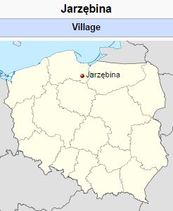
Schulwiese (now known as Jarzębina; coordinates: 53.85381, 18.89242 [53° 51′ 13″ N, 18° 53′ 32″ E]; population in 1905, 159; in 2013, 130); is located 13.5 kilometres (km) north of Kwidzyn (Marienwerder), 22.5 km south south-west of Malbork (Marienburg), 25.7 km east south-east of Starogard Gdański (Preußisch Stargard), and 28.1 km south south-east of Tczew (Dirschau). It was situated south of Rudnerweide and west of Klein Schardau.
The first mention of Schulwiese is in 1624. The First Partition of Poland in 1772 resulted in the creation of a new province in 1773, called West Prussia, in which Schulwiese was located. Schulwiese was situated in the district (Kreis) of Marienwerder until the end of World War I, when it came under the jurisdiction of the German province of East Prussia. Schulwiese came under the control of Nazi Germany during World War II until February 1945, when it was occupied by Soviet forces and returned to Poland. In 2012 Schulwiese (now Jarzębina) was a village in the administrative district of Gmina Ryjewo, within Kwidzyn County, Pomeranian Voivodeship.
Schulwiese was settled by Mennonites in the 18th century. Inhabitants mentioned in 1748 include: Martin Zimen, Wilhelm Unrau, Hendrich Gertzen, Heinrich Frantzen, Tobias Ecker, and Martin Simon. The 1776 Prussian census lists 30 Mennonite families in the village with the following surnames: Abraham, Baltzer, Casper, Ediger, Ewert, Fodt, Goertz, Goertzen, Jantzen, Knelsen, Nickel, Pauls, Penner, Quiring, and Schmidt.
Maps
Schulwiese, Pomeranian Voivodeship, Poland
Bibliography
Stowarzyszenie Konserwatorów Zabytków. "Jarzębina." Catalogue of Monuments of Dutch Colonization in Poland. 2005. Web. 11 September 2014. http://holland.org.pl/art.php?kat=obiekt&id=515&lang=en.
Wikipedia. "Jarzębina, Pomeranian Voivodeship." 21 August 2013. Web. 11 September 2014. https://en.wikipedia.org/wiki/Jarz%C4%99bina,_Pomeranian_Voivodeship.
Wolf, Hans-Jürgen. "Familienforschung in Westpreußen." Web. 11 September 2014. http://www.westpreussen.de/cms/ct/ortsverzeichnis/details.php?ID=5976.
| Author(s) | Richard D Thiessen |
|---|---|
| Date Published | September 2014 |
Cite This Article
MLA style
Thiessen, Richard D. "Schulwiese (Pomeranian Voivodeship, Poland)." Global Anabaptist Mennonite Encyclopedia Online. September 2014. Web. 12 Feb 2026. https://gameo.org/index.php?title=Schulwiese_(Pomeranian_Voivodeship,_Poland)&oldid=124565.
APA style
Thiessen, Richard D. (September 2014). Schulwiese (Pomeranian Voivodeship, Poland). Global Anabaptist Mennonite Encyclopedia Online. Retrieved 12 February 2026, from https://gameo.org/index.php?title=Schulwiese_(Pomeranian_Voivodeship,_Poland)&oldid=124565.
©1996-2026 by the Global Anabaptist Mennonite Encyclopedia Online. All rights reserved.

