Kicin (Masovian Voivodeship, Poland)

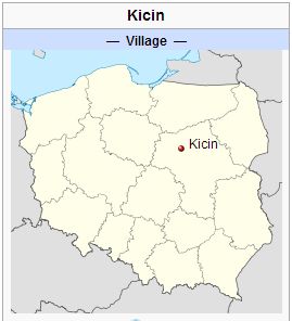
Kicin (coordinates: 52.7436° N, 20.5247° E [52° 44′ 36.96″ N, 20° 31′ 28.92″ E]), a village near Vola-Vodzinska and 68 km. (42 mi.) north-west of Warsaw, Poland, was established by German Mennonite and Lutheran settlers on the estate of Count Kicinski around 1842. Evidently the Mennonite settlers came from the Deutsch-Kazun Mennonite settlement near Warsaw. Peter Ewert of this community took a large number of the Mennonites with him into the Baptist Church, which was started here in 1855. Mennonites of this community were probably members of the Vola-Vodzinska Mennonite Church, which in turn was a subsidiary of Deutsch-Kazun.
Bibliography
Kupsch, Eduard. Geschichte der Baptisten in Polen. Lodz, 1932: 59 ff.
Maps
Map:Kicin, Masovian Voivodeship, Poland
| Author(s) | Cornelius Krahn |
|---|---|
| Richard D. Thiessen | |
| Date Published | October 2012 |
Cite This Article
MLA style
Krahn, Cornelius and Richard D. Thiessen. "Kicin (Masovian Voivodeship, Poland)." Global Anabaptist Mennonite Encyclopedia Online. October 2012. Web. 22 Nov 2024. https://gameo.org/index.php?title=Kicin_(Masovian_Voivodeship,_Poland)&oldid=133504.
APA style
Krahn, Cornelius and Richard D. Thiessen. (October 2012). Kicin (Masovian Voivodeship, Poland). Global Anabaptist Mennonite Encyclopedia Online. Retrieved 22 November 2024, from https://gameo.org/index.php?title=Kicin_(Masovian_Voivodeship,_Poland)&oldid=133504.
Adapted by permission of Herald Press, Harrisonburg, Virginia, from Mennonite Encyclopedia, Vol. 3, p. 173. All rights reserved.
©1996-2024 by the Global Anabaptist Mennonite Encyclopedia Online. All rights reserved.
