Difference between revisions of "Grunau (Warmian-Masurian Voivodeship, Poland)"
| [unchecked revision] | [checked revision] |
GameoAdmin (talk | contribs) (CSV import - 20130816) |
AlfRedekopp (talk | contribs) |
||
| (3 intermediate revisions by 2 users not shown) | |||
| Line 1: | Line 1: | ||
| − | + | [[File:Grunau%20emblem.jpg|300px|thumb|right|''Grunau (now Gronowo Elbląskie, Poland) | |
| − | Source: [http://en.wikipedia.org/wiki/Gronowo_Elbl%C4%85skie Wikipedia Commons] | + | Source: [http://en.wikipedia.org/wiki/Gronowo_Elbl%C4%85skie Wikipedia Commons]'']] [[File:Grunau.jpg|300px|thumb|right|''Grunau (now Gronowo Elbląskie, Poland) |
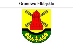
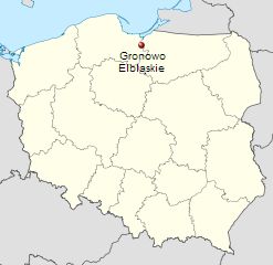
| − | + | Source: [http://en.wikipedia.org/wiki/Gronowo_Elbl%C4%85skie Wikipedia Commons]'']] Grunau (also known as Grunav, Gronau, and Gronowo Dolne; now known as Gronowo Elbląskie; coordinates: 54.085, 19.307222 [54° 5′ 6″ N, 19° 18′ 26″ E]; population in 1905, 376; in 2013, 1,600) is located approximately 7 kilometres (4 miles) west of Elbląg ([[Elbing (Warmian-Masurian Voivodeship, Poland)|Elbing]]) and 86 km. (53 mi.) north-west of the regional capital Olsztyn (Allenstein). | |
| − | |||
| − | Source: [http://en.wikipedia.org/wiki/Gronowo_Elbl%C4%85skie Wikipedia Commons] | ||
| − | |||
| − | '']] Grunau (also known as Grunav, Gronau, and Gronowo Dolne; now known as Gronowo Elbląskie; coordinates: 54.085, 19.307222 [54° 5′ 6″ N, 19° 18′ 26″ E]; population in 1905, 376; in 2013, 1,600) is located approximately 7 kilometres (4 miles) west of Elbląg ([[Elbing (Warmian-Masurian Voivodeship, Poland)|Elbing]]) and 86 km. (53 mi.) north-west of the regional capital Olsztyn (Allenstein). | ||
Grunau was first mentioned in historical documents in 1411 and was granted rights for the second time in 1414 by the commander Herman Gans. It is probable that at that time, two nearby villages of Gross and Klein Winkelsdorf were incorporated into Grunau. At that time the village was 790 hectares (44 Chełmno włóksa). Until 1772 the village was located in what was known as Royal Prussia (also known as Polish Prussia) in the Kingdom of [[Poland|Poland]]. The First Partition of Poland in 1772 resulted in the creation of a new province in 1773, called [[West Prussia|West Prussia]], in which the village was located. The village was situated in the district (Kreis) of Marienburg until the end of World War I, when it came under the jurisdiction of the German province of [[East Prussia|East Prussia]]. In 2012 Grunau (now Gronowo Elbląskie) was a village in the administrative district of Gmina Gronowo Elbląskie, Elbląg County, Warmian-Masurian Voivodeship. | Grunau was first mentioned in historical documents in 1411 and was granted rights for the second time in 1414 by the commander Herman Gans. It is probable that at that time, two nearby villages of Gross and Klein Winkelsdorf were incorporated into Grunau. At that time the village was 790 hectares (44 Chełmno włóksa). Until 1772 the village was located in what was known as Royal Prussia (also known as Polish Prussia) in the Kingdom of [[Poland|Poland]]. The First Partition of Poland in 1772 resulted in the creation of a new province in 1773, called [[West Prussia|West Prussia]], in which the village was located. The village was situated in the district (Kreis) of Marienburg until the end of World War I, when it came under the jurisdiction of the German province of [[East Prussia|East Prussia]]. In 2012 Grunau (now Gronowo Elbląskie) was a village in the administrative district of Gmina Gronowo Elbląskie, Elbląg County, Warmian-Masurian Voivodeship. | ||
| Line 14: | Line 10: | ||
Mennonites who were residents of Grunau were members of the Thiensdorf-[[Markushof (Warmian-Masurian Voivodeship, Poland)|Markushof]] Mennonite Church. | Mennonites who were residents of Grunau were members of the Thiensdorf-[[Markushof (Warmian-Masurian Voivodeship, Poland)|Markushof]] Mennonite Church. | ||
| − | |||
| − | |||
= Bibliography = | = Bibliography = | ||
Stowarzyszenie Konserwatorów Zabytków. "Gronowo Elbląskie (Gronowo Dolne)." Catalogue of Monuments of Dutch Colonization in Poland. 2005. Web. 3 February 2013. [http://holland.org.pl/art.php http://holland.org.pl/art.php?kat=obiekt&id=329&lang=en]. | Stowarzyszenie Konserwatorów Zabytków. "Gronowo Elbląskie (Gronowo Dolne)." Catalogue of Monuments of Dutch Colonization in Poland. 2005. Web. 3 February 2013. [http://holland.org.pl/art.php http://holland.org.pl/art.php?kat=obiekt&id=329&lang=en]. | ||
| Line 21: | Line 15: | ||
Wikipedia. "Gronowo Elbląskie." Web. 3 February 2013. [http://en.wikipedia.org/wiki/Gronowo_Elbląskie http://en.wikipedia.org/wiki/Gronowo_Elbląskie]. | Wikipedia. "Gronowo Elbląskie." Web. 3 February 2013. [http://en.wikipedia.org/wiki/Gronowo_Elbląskie http://en.wikipedia.org/wiki/Gronowo_Elbląskie]. | ||
| − | Wolf, Hans-Jürgen. "Familienforschung in Westpreußen." Web. 3 February 2013. [http://www.westpreussen.de/ | + | Wolf, Hans-Jürgen. "Familienforschung in Westpreußen." Web. 3 February 2013. [http://www.westpreussen.de/pages/forschungshilfen/ortsverzeichnis/details.php?ID=2231 http://www.westpreussen.de/pages/forschungshilfen/ortsverzeichnis/details.php?ID=2231]. |
| − | |||
| − | |||
= Maps = | = Maps = | ||
[[Map:Gronowo Elbląskie, Warmian-Masurian Voivodeship, Poland|Map:Gronowo Elbląskie, Warmian-Masurian Voivodeship, Poland]] | [[Map:Gronowo Elbląskie, Warmian-Masurian Voivodeship, Poland|Map:Gronowo Elbląskie, Warmian-Masurian Voivodeship, Poland]] | ||
{{GAMEO_footer|hp=|date=February 2013|a1_last=Thiessen|a1_first=Richard D|a2_last=|a2_first=}} | {{GAMEO_footer|hp=|date=February 2013|a1_last=Thiessen|a1_first=Richard D|a2_last=|a2_first=}} | ||
Latest revision as of 14:58, 23 June 2020


Grunau (also known as Grunav, Gronau, and Gronowo Dolne; now known as Gronowo Elbląskie; coordinates: 54.085, 19.307222 [54° 5′ 6″ N, 19° 18′ 26″ E]; population in 1905, 376; in 2013, 1,600) is located approximately 7 kilometres (4 miles) west of Elbląg (Elbing) and 86 km. (53 mi.) north-west of the regional capital Olsztyn (Allenstein).
Grunau was first mentioned in historical documents in 1411 and was granted rights for the second time in 1414 by the commander Herman Gans. It is probable that at that time, two nearby villages of Gross and Klein Winkelsdorf were incorporated into Grunau. At that time the village was 790 hectares (44 Chełmno włóksa). Until 1772 the village was located in what was known as Royal Prussia (also known as Polish Prussia) in the Kingdom of Poland. The First Partition of Poland in 1772 resulted in the creation of a new province in 1773, called West Prussia, in which the village was located. The village was situated in the district (Kreis) of Marienburg until the end of World War I, when it came under the jurisdiction of the German province of East Prussia. In 2012 Grunau (now Gronowo Elbląskie) was a village in the administrative district of Gmina Gronowo Elbląskie, Elbląg County, Warmian-Masurian Voivodeship.
The Prussian census of 1776 lists 11 Mennonite families in Gruanu with the following surnames: Cornelius, Frantz, Froes, Jantzen, Nickel, Pauls, Penner, Sperling, and Unger. At the end of the 18th century, Grunau had 32 homesteads. In 1820, there were 63 Mennonites among 247 residents. In the 2nd half of the 19th century, the village acreage equalled 79 włókas (1,418 hectares). There were 18 homesteads, 35 houses, and 370 residents, including 65 Mennonites.
Mennonites who were residents of Grunau were members of the Thiensdorf-Markushof Mennonite Church.
Bibliography
Stowarzyszenie Konserwatorów Zabytków. "Gronowo Elbląskie (Gronowo Dolne)." Catalogue of Monuments of Dutch Colonization in Poland. 2005. Web. 3 February 2013. http://holland.org.pl/art.php?kat=obiekt&id=329&lang=en.
Wikipedia. "Gronowo Elbląskie." Web. 3 February 2013. http://en.wikipedia.org/wiki/Gronowo_Elbląskie.
Wolf, Hans-Jürgen. "Familienforschung in Westpreußen." Web. 3 February 2013. http://www.westpreussen.de/pages/forschungshilfen/ortsverzeichnis/details.php?ID=2231.
Maps
Map:Gronowo Elbląskie, Warmian-Masurian Voivodeship, Poland
| Author(s) | Richard D Thiessen |
|---|---|
| Date Published | February 2013 |
Cite This Article
MLA style
Thiessen, Richard D. "Grunau (Warmian-Masurian Voivodeship, Poland)." Global Anabaptist Mennonite Encyclopedia Online. February 2013. Web. 3 Feb 2026. https://gameo.org/index.php?title=Grunau_(Warmian-Masurian_Voivodeship,_Poland)&oldid=168561.
APA style
Thiessen, Richard D. (February 2013). Grunau (Warmian-Masurian Voivodeship, Poland). Global Anabaptist Mennonite Encyclopedia Online. Retrieved 3 February 2026, from https://gameo.org/index.php?title=Grunau_(Warmian-Masurian_Voivodeship,_Poland)&oldid=168561.
©1996-2026 by the Global Anabaptist Mennonite Encyclopedia Online. All rights reserved.