Difference between revisions of "Kicin (Masovian Voivodeship, Poland)"
| [checked revision] | [checked revision] |
GameoAdmin (talk | contribs) (CSV import - 20130823) |
m (Added categories.) |
||
| Line 1: | Line 1: | ||
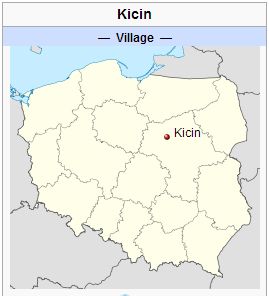
| − | [[File:Kicin.jpg|300px|thumb|right|''Source: [http://en.wikipedia.org/wiki/Kicin,_Masovian_Voivodeship Wikipedia Commons]'']] | + | [[File:Kicin.jpg|300px|thumb|right|''Source: [http://en.wikipedia.org/wiki/Kicin,_Masovian_Voivodeship Wikipedia Commons]'']] |
| + | Kicin (coordinates: 52.7436° N, 20.5247° E [52° 44′ 36.96″ N, 20° 31′ 28.92″ E]), a village near [[Vola-Vodzinska Mennonite Church (Płońsk, Masovian Voivodeship, Poland)|Vola-Vodzinska]] and 68 km. (42 mi.) north-west of Warsaw, [[Poland|Poland]], was established by German Mennonite and Lutheran settlers on the estate of Count Kicinski around 1842. Evidently the Mennonite settlers came from the [[Deutsch-Kazun (Poland)|Deutsch-Kazun Mennonite settlement]] near Warsaw. Peter Ewert of this community took a large number of the Mennonites with him into the Baptist Church, which was started here in 1855. Mennonites of this community were probably members of the Vola-Vodzinska Mennonite Church, which in turn was a subsidiary of Deutsch-Kazun. | ||
= Bibliography = | = Bibliography = | ||
Kupsch, Eduard. <em>Geschichte der Baptisten in Polen</em>. Lodz, 1932: 59 ff. | Kupsch, Eduard. <em>Geschichte der Baptisten in Polen</em>. Lodz, 1932: 59 ff. | ||
| Line 6: | Line 7: | ||
[[Map:Kicin, Masovian Voivodeship, Poland|Map:Kicin, Masovian Voivodeship, Poland]] | [[Map:Kicin, Masovian Voivodeship, Poland|Map:Kicin, Masovian Voivodeship, Poland]] | ||
{{GAMEO_footer|hp=Vol. 3, p. 173|date=October 2012|a1_last=Krahn|a1_first=Cornelius|a2_last=Thiessen|a2_first=Richard D.}} | {{GAMEO_footer|hp=Vol. 3, p. 173|date=October 2012|a1_last=Krahn|a1_first=Cornelius|a2_last=Thiessen|a2_first=Richard D.}} | ||
| + | [[Category:Places]] | ||
| + | [[Category:Cities, Towns, and Villages]] | ||
| + | [[Category:Cities, Towns, and Villages in Poland]] | ||
Latest revision as of 06:55, 9 February 2016

Kicin (coordinates: 52.7436° N, 20.5247° E [52° 44′ 36.96″ N, 20° 31′ 28.92″ E]), a village near Vola-Vodzinska and 68 km. (42 mi.) north-west of Warsaw, Poland, was established by German Mennonite and Lutheran settlers on the estate of Count Kicinski around 1842. Evidently the Mennonite settlers came from the Deutsch-Kazun Mennonite settlement near Warsaw. Peter Ewert of this community took a large number of the Mennonites with him into the Baptist Church, which was started here in 1855. Mennonites of this community were probably members of the Vola-Vodzinska Mennonite Church, which in turn was a subsidiary of Deutsch-Kazun.
Bibliography
Kupsch, Eduard. Geschichte der Baptisten in Polen. Lodz, 1932: 59 ff.
Maps
Map:Kicin, Masovian Voivodeship, Poland
| Author(s) | Cornelius Krahn |
|---|---|
| Richard D. Thiessen | |
| Date Published | October 2012 |
Cite This Article
MLA style
Krahn, Cornelius and Richard D. Thiessen. "Kicin (Masovian Voivodeship, Poland)." Global Anabaptist Mennonite Encyclopedia Online. October 2012. Web. 25 Nov 2024. https://gameo.org/index.php?title=Kicin_(Masovian_Voivodeship,_Poland)&oldid=133504.
APA style
Krahn, Cornelius and Richard D. Thiessen. (October 2012). Kicin (Masovian Voivodeship, Poland). Global Anabaptist Mennonite Encyclopedia Online. Retrieved 25 November 2024, from https://gameo.org/index.php?title=Kicin_(Masovian_Voivodeship,_Poland)&oldid=133504.
Adapted by permission of Herald Press, Harrisonburg, Virginia, from Mennonite Encyclopedia, Vol. 3, p. 173. All rights reserved.
©1996-2024 by the Global Anabaptist Mennonite Encyclopedia Online. All rights reserved.
