Putnam County (Ohio, USA)
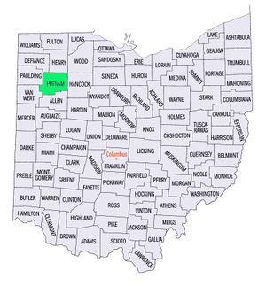
Putnam County, Ohio, lies in the "Black Swamp" area of northwestern Ohio and was formed from Old Indian Territory in 1820. The land is level and wet but very fertile when drained. Between 1834 and 1850 a large Swiss Mennonite settlement sprang up in southeastern Putnam and northeastern Allen counties. The struggling Blanchard Mennonite Church (Mennonite Church) was founded in the west-central part of the county in 1836.
| Author(s) | John S Umble |
|---|---|
| Date Published | 1959 |
Cite This Article
MLA style
Umble, John S. "Putnam County (Ohio, USA)." Global Anabaptist Mennonite Encyclopedia Online. 1959. Web. 18 Apr 2024. https://gameo.org/index.php?title=Putnam_County_(Ohio,_USA)&oldid=67411.
APA style
Umble, John S. (1959). Putnam County (Ohio, USA). Global Anabaptist Mennonite Encyclopedia Online. Retrieved 18 April 2024, from https://gameo.org/index.php?title=Putnam_County_(Ohio,_USA)&oldid=67411.
Adapted by permission of Herald Press, Harrisonburg, Virginia, from Mennonite Encyclopedia, Vol. 4, p. 236. All rights reserved.
©1996-2024 by the Global Anabaptist Mennonite Encyclopedia Online. All rights reserved.

