File:Thiensdorf-Markushof detailed map.jpg
Revision as of 06:51, 18 August 2014 by RichardThiessen (talk | contribs)

Size of this preview: 610 × 599 pixels. Other resolutions: 244 × 240 pixels | 1,000 × 982 pixels.
Original file (1,000 × 982 pixels, file size: 331 KB, MIME type: image/jpeg)
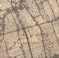
Detailed map of Thiensdorf and Markushof, early 20th century.
Source: Archiwalne Mapy Pomorza Gdańskiego.
File history
Click on a date/time to view the file as it appeared at that time.
| Date/Time | Thumbnail | Dimensions | User | Comment | |
|---|---|---|---|---|---|
| current | 17:14, 23 August 2013 |  | 1,000 × 982 (331 KB) | Maintenance script (talk) | Detailed map of Thiensdorf and Markushof, early 20th century. Source: [http://www.mapy.eksploracja.pl/messtischblatt/1982_thiergard.htm Archiwalne Mapy Pomorza Gdańskiego] |
| 20:31, 16 August 2013 |  | 1,000 × 982 (331 KB) | Maintenance script (talk) | Detailed map of Thiensdorf and Markushof, early 20th century. Source: [http://www.mapy.eksploracja.pl/messtischblatt/1982_thiergard.htm Archiwalne Mapy Pomorza Gdańskiego] Archiwalne Mapy Pomorza Gdańskiego |
You cannot overwrite this file.
File usage
The following 2 pages use this file: