Difference between revisions of "Wartenberg (Rheinland-Pfalz, Germany)"
| [unchecked revision] | [checked revision] |
GameoAdmin (talk | contribs) (CSV import - 20130820) |
m |
||
| (3 intermediate revisions by 3 users not shown) | |||
| Line 1: | Line 1: | ||
| − | [[File:Wartenberg.jpg|300px|thumb|right|''Wartenberg (Germany) | + | [[File:Wartenberg.jpg|300px|thumb|right|'' Wartenberg (Germany).<br /> |
| − | + | Source: [http://commons.wikimedia.org/wiki/Main_Page Wikipedia Commons]'']] | |
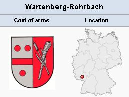
| − | Source: [http://commons.wikimedia.org/wiki/Main_Page Wikipedia Commons] | + | Wartenberg in the [[Palatinate (Rheinland-Pfalz, Germany)|Palatinate]], Germany (coordinates: 49° 31′ 34″ N 7° 51′ 12″ E). Until ca. 1780 the present congregation of [[Sembach (Rheinland-Pfalz, Germany)|Sembach]] was sometimes - as in the Dutch <em>[[Naamlijst der tegenwoordig in dienst zijnde predikanten der Mennoniten in de Vereenigde Nederlanden|Naamlijst]]</em> - called either simply Wartenberg or Wartenberg-Sembach, since some of the elders and preachers lived at Wartenberg. |
| − | |||
| − | '']] | ||
| − | in de Vereenigde Nederlanden|Naamlijst]]</em> - called either simply Wartenberg or Wartenberg-Sembach, since some of the elders and preachers lived at Wartenberg. | ||
= Additional Information = | = Additional Information = | ||
[http://maps.google.ca/maps View Google Map] | [http://maps.google.ca/maps View Google Map] | ||
| − | {{GAMEO_footer|hp=Vol. 4, p. 891|date=1959|a1_last= | + | {{GAMEO_footer|hp=Vol. 4, p. 891|date=1959|a1_last=Zijpp|a1_first=Nanne van der|a2_last= |a2_first= }} |
Latest revision as of 06:42, 18 July 2016
Wartenberg in the Palatinate, Germany (coordinates: 49° 31′ 34″ N 7° 51′ 12″ E). Until ca. 1780 the present congregation of Sembach was sometimes - as in the Dutch Naamlijst - called either simply Wartenberg or Wartenberg-Sembach, since some of the elders and preachers lived at Wartenberg.
Additional Information
| Author(s) | Nanne van der Zijpp |
|---|---|
| Date Published | 1959 |
Cite This Article
MLA style
Zijpp, Nanne van der. "Wartenberg (Rheinland-Pfalz, Germany)." Global Anabaptist Mennonite Encyclopedia Online. 1959. Web. 19 Jan 2026. https://gameo.org/index.php?title=Wartenberg_(Rheinland-Pfalz,_Germany)&oldid=135117.
APA style
Zijpp, Nanne van der. (1959). Wartenberg (Rheinland-Pfalz, Germany). Global Anabaptist Mennonite Encyclopedia Online. Retrieved 19 January 2026, from https://gameo.org/index.php?title=Wartenberg_(Rheinland-Pfalz,_Germany)&oldid=135117.
Adapted by permission of Herald Press, Harrisonburg, Virginia, from Mennonite Encyclopedia, Vol. 4, p. 891. All rights reserved.
©1996-2026 by the Global Anabaptist Mennonite Encyclopedia Online. All rights reserved.

