File:WLM - M.arjon - Middelie Middelie 79.jpg
Jump to navigation
Jump to search


Size of this preview: 800 × 600 pixels. Other resolutions: 320 × 240 pixels | 640 × 480 pixels | 1,024 × 768 pixels | 1,280 × 960 pixels | 3,264 × 2,448 pixels.
Original file (3,264 × 2,448 pixels, file size: 4.02 MB, MIME type: image/jpeg)
Summary
| Description |
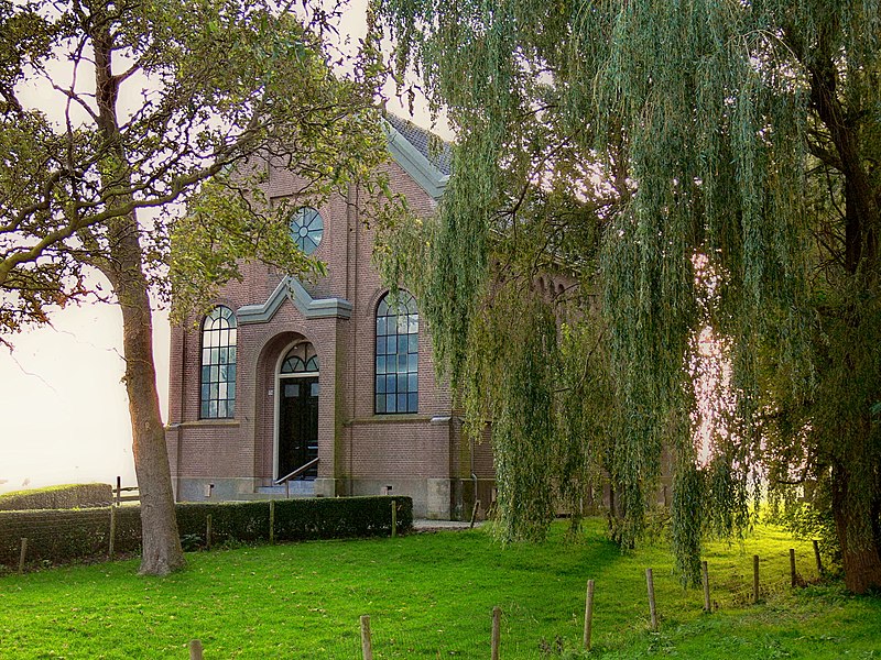
Doopsgezinde Vermaning, gesitueerd op ruim erf aan de westzijde van de straat en hiervan door een ijzeren spijlenhek gescheiden. De in sobere trant opgetrokken vermaning werd in 1899 gebouwd ter vervanging van een houten voorganger die zich op een terrein achter de huidige kerk bevond. De Doopsgezinden noemen hun kerkgebouw ook wel een vermaning. Een vermaning is een plaats van bemoediging.
|
||
| Date | |||
| Source | Middelie Middelie 79 | ||
| Author | Marjon from The Netherlands |
| Object location | | View this and other nearby images on: OpenStreetMap |
|---|
Licensing
This image was uploaded as part of Wiki Loves Monuments 2010.
|
This file is licensed under the Creative Commons Attribution-Share Alike 2.0 Generic license.
- You are free:
- to share – to copy, distribute and transmit the work
- to remix – to adapt the work
- Under the following conditions:
- attribution – You must give appropriate credit, provide a link to the license, and indicate if changes were made. You may do so in any reasonable manner, but not in any way that suggests the licensor endorses you or your use.
- share alike – If you remix, transform, or build upon the material, you must distribute your contributions under the same or compatible license as the original.
| This image, originally posted to Flickr, was reviewed on 22 September 2010 by the administrator or reviewer Multichill, who confirmed that it was available on Flickr under the stated license on that date. |
File history
Click on a date/time to view the file as it appeared at that time.
| Date/Time | Thumbnail | Dimensions | User | Comment | |
|---|---|---|---|---|---|
| current | 13:45, 22 September 2010 | | 3,264 × 2,448 (4.02 MB) | BotMultichillT | {{Information |Description=Doopsgezinde Vermaning, gesitueerd op ruim erf aan de westzijde van de straat en hiervan door een ijzeren spijlenhek gescheiden. De in sobere trant opgetrokken vermaning werd in 1899 gebouwd ter vervanging van een houten voorgan |
File usage
There are no pages that use this file.