File:Thiensdorf-Markushof detailed map.jpg
Revision as of 17:14, 23 August 2013 by Maintenance script (talk) (Maintenance script uploaded a new version of "File:Thiensdorf-Markushof detailed map.jpg": Detailed map of Thiensdorf and Markushof, early 20th century. Source: [http://www.mapy.eksploracja.pl/messtischblatt/1982_thiergard.htm Archiwalne Ma)
The printable version is no longer supported and may have rendering errors. Please update your browser bookmarks and please use the default browser print function instead.
Size of this preview: 610 × 599 pixels. Other resolutions: 244 × 240 pixels | 1,000 × 982 pixels.
Original file (1,000 × 982 pixels, file size: 331 KB, MIME type: image/jpeg)
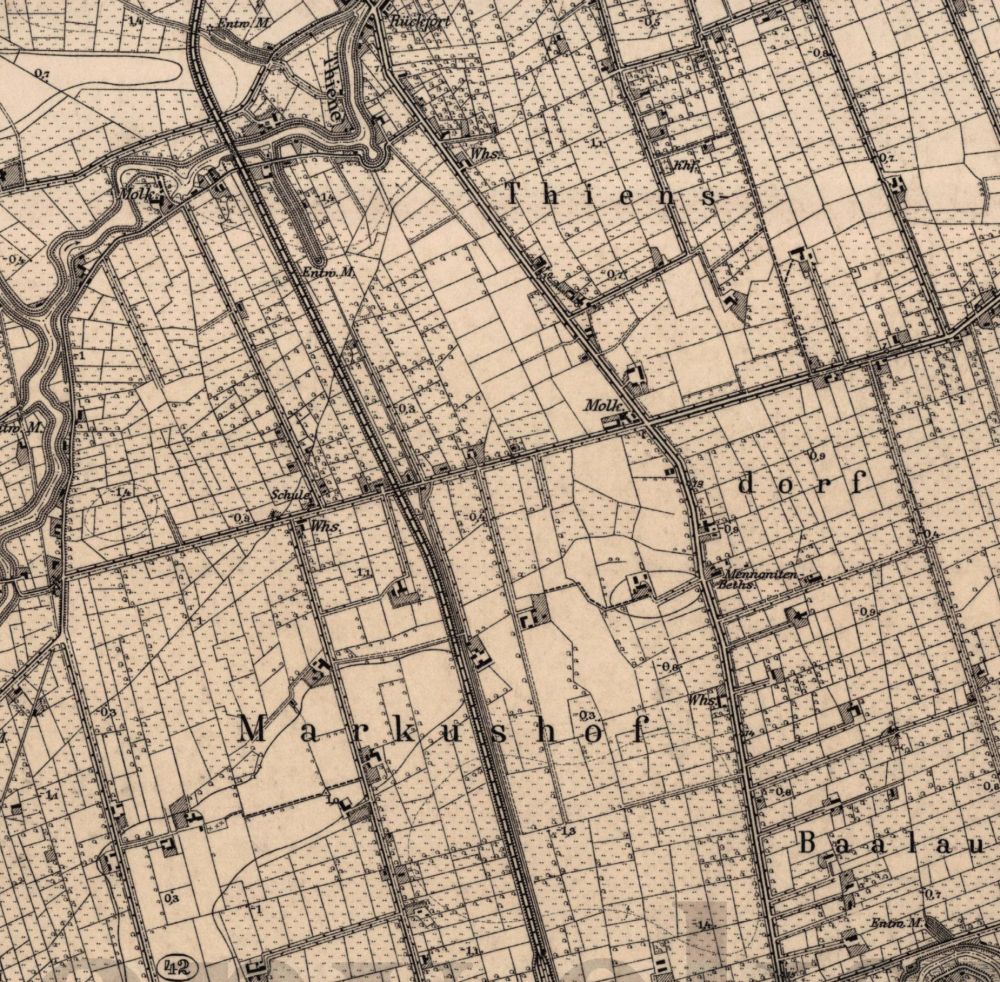
Detailed map of Thiensdorf and Markushof, early 20th century.
Source: Archiwalne Mapy Pomorza Gdańskiego Archiwalne Mapy Pomorza Gdańskiego
File history
Click on a date/time to view the file as it appeared at that time.
| Date/Time | Thumbnail | Dimensions | User | Comment | |
|---|---|---|---|---|---|
| current | 17:14, 23 August 2013 | | 1,000 × 982 (331 KB) | Maintenance script (talk) | Detailed map of Thiensdorf and Markushof, early 20th century. Source: [http://www.mapy.eksploracja.pl/messtischblatt/1982_thiergard.htm Archiwalne Mapy Pomorza Gdańskiego] |
| 20:31, 16 August 2013 |  | 1,000 × 982 (331 KB) | Maintenance script (talk) | Detailed map of Thiensdorf and Markushof, early 20th century. Source: [http://www.mapy.eksploracja.pl/messtischblatt/1982_thiergard.htm Archiwalne Mapy Pomorza Gdańskiego] Archiwalne Mapy Pomorza Gdańskiego |
You cannot overwrite this file.
File usage
The following 2 pages use this file: