File:RosenortLakendorfKrebsfelde.jpg

Size of this preview: 800 × 489 pixels. Other resolutions: 320 × 196 pixels | 1,000 × 611 pixels.
Original file (1,000 × 611 pixels, file size: 249 KB, MIME type: image/jpeg)
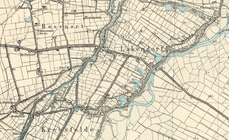
Detailed map of Rosenort, early 20th century.
Source: Archiwum Map Zachodniej Polski Archiwum Map Zachodniej Polski
File history
Click on a date/time to view the file as it appeared at that time.
| Date/Time | Thumbnail | Dimensions | User | Comment | |
|---|---|---|---|---|---|
| current | 17:09, 23 August 2013 | | 1,000 × 611 (249 KB) | Maintenance script (talk) | Detailed map of Rosenort, early 20th century. Source: [http://amzpbig.com/maps/1881_Zeyer_1931.jpg Archiwum Map Zachodniej Polski] |
| 20:24, 16 August 2013 | 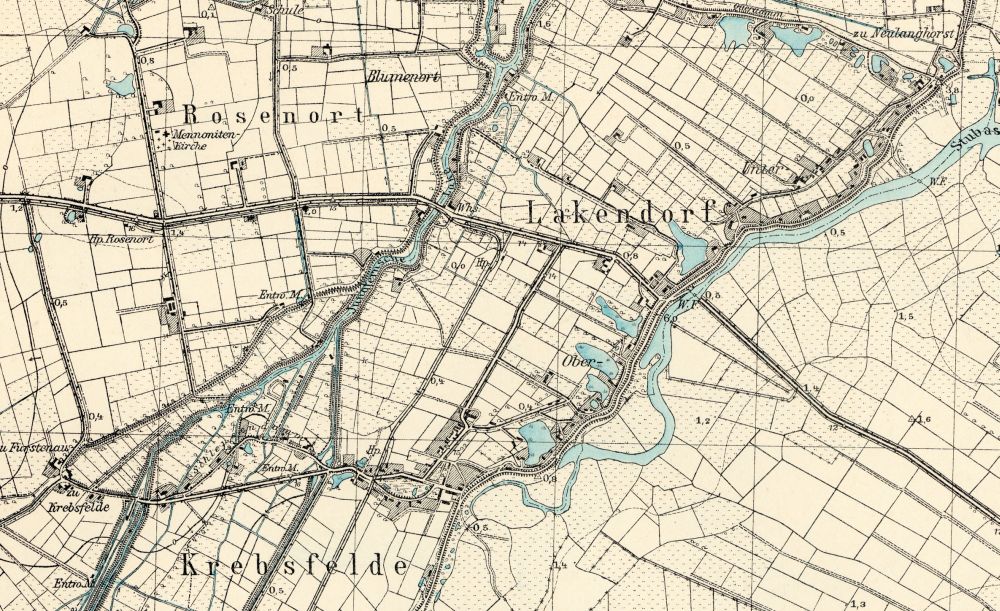 | 1,000 × 611 (249 KB) | Maintenance script (talk) | Detailed map of Rosenort, early 20th century. Source: [http://amzpbig.com/maps/1881_Zeyer_1931.jpg Archiwum Map Zachodniej Polski] Archiwum Map Zachodniej Polski |
You cannot overwrite this file.